We use cookies to personalise site content, social media features and to analyse our traffic. We also share information about your use of this site with our advertising and social media partners.
FEATURED
SPONSORED
VERIFIED
Mar 6 -
5 minutes, 43 seconds
-2.5K Views 10 Comments 0 Likes 0 Reviews
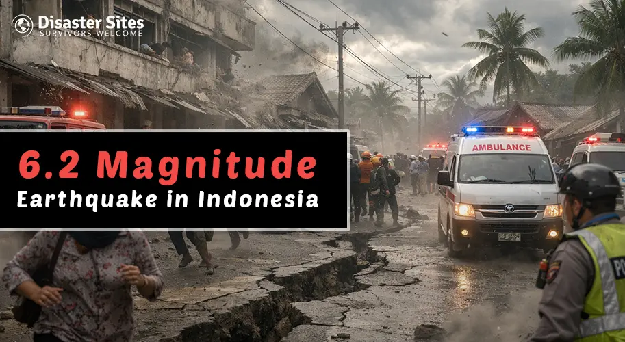
On March 3, 2026, a powerful 6.2 magnitude earthquake struck off the coast of Aceh, northern Sumatra, Indonesia. Residents rushed out of buildings, streets filled with panicked people, and emergency lines lit up within seconds. Although authorities confirmed no tsunami warning was issued, for the people of Aceh, a province that lost over 167,000 lives in the catastrophic 2004 Indian Ocean disaster, even a moderate tremor is terrifying.
This blog breaks down the real causes behind this earthquake, who is currently affected, and what the situation looks like on the ground right now.
Indonesia doesn't experience earthquakes by coincidence. It sits at the intersection of three major tectonic plates, the Pacific, Eurasian, and Australian plates, right on the Pacific Ring of Fire. This is one of the most geologically violent zones on Earth.
The Aceh region sits directly above the Sunda Subduction Zone, where the Australian plate pushes beneath the Eurasian plate at roughly 6–7 centimetres per year. This relentless collision builds enormous pressure in the earth's crust which eventually releases, sometimes violently as an earthquake.
The March 3 tremor was shallow that occurred only about 20 km beneath the ocean floor. Shallow earthquakes are more dangerous than deep ones because the energy has less distance to travel before reaching the surface, resulting in stronger, more destructive shaking even if the magnitude seems moderate.
The USGS ranks Indonesia as the most seismically active country in the world, experiencing an average of 20 earthquakes every single day, most too small to feel, but enough to keep the country permanently on alert.
The epicentre struck off the coast of Aceh province, home to approximately 5.4 million people. Major population centres in the impact zone include Banda Aceh, Lhokseumawe, and Langsa. Coastal communities across northern Sumatra felt the tremors most intensely.
Aceh carries one of the heaviest disaster histories in the world. The 2004 Indian Ocean earthquake and tsunami, which originated just off this same coastline, killed more than 167,000 Indonesians, the majority from Aceh. That trauma never fully fades. When the ground shakes in Aceh, the response is immediate and visceral, people don't wait, they run.
For context on how serious a 6.2 magnitude quake can be on land: the January 2021 earthquake of the same magnitude in West Sulawesi killed 107 people and displaced over 71,000 residents. The offshore location of this March 2026 event is the primary reason casualties appear to have been avoided.
As of reporting, no major casualties or structural collapses have been confirmed. The Indonesian national geophysics agency BMKG, began its post-earthquake emergency procedures after an earthquake struck and sent emergency response teams to evaluate the coastal regions of Aceh.
The InAWARE disaster system of Indonesia sent automatic SMS warnings to residents who lived close to the coast. The local disaster management offices, BPBD Aceh, performed visual assessments of bridges, roads and public facilities during the first hours after the earthquake.
The possibility of aftershocks happening during the upcoming days presents a major threat to the region. Earthquakes that occur along the Sunda subduction zone result in multiple aftershocks, which sometimes generate tremors that reach magnitude 5.0 and greater, thereby inflicting extra destruction on structures that already suffer from damage.
The authorities maintain their continuous monitoring of the situation throughout all hours of the day.
The March 3, 2026, earthquake off Aceh is yet another stark reminder that Indonesia's 270 million people live on one of the most geologically dangerous pieces of land on the planet. The causes are deep, ancient, and unstoppable, tectonic forces that no government or technology can prevent.
What can be controlled is preparedness, response speed, and public awareness. Aceh's community has survived the worst the Earth can offer, and its resilience is extraordinary. But resilience alone is not enough, real-time information saves lives.
Visit Disaster Sites regularly for verified, real-time updates, earthquake alerts, and ground-level reports from Indonesia and disaster zones worldwide.

“To assist disaster survivors by providing a source for them to come together in time of need, to aid in the listing of events, information and other forms of assistance, and continuing support through the recovery process.”

Share this page with your family and friends.